
This startup is sharing high-res images of Earth taken from high-altitude balloons
You may have heard about how organizations use satellites and drones to capture useful images of the Earth — high-resolution pictures that can help people understand how changes on the ground will impact their business or people's lives. For the past five years, the startup Near Space Labs has provided similar imagery — using a fleet of balloons that flies in the stratosphere.
Now, the aerospace startup Near Space Labs (NSL) is making their high-resolution imagery of Earth available for free to universities, nonprofit organizations, and researchers.
NSL offers images with 10-centimeter per pixel resolution. The images are so clear they can pick up road conditions, roofing details, vegetation, or even a soccer ball on the ground. There are a number of commercial use cases for NSL's technology. Insurance companies, for instance, can use it for property assessments, while energy companies could use it to monitor their solar panels or oil fields.
Popular now
Now, with its Community Resilience & Innovation Earth Imagery Grant program, NSL will release imagery of the most populated cities in the US. NSL says it wants to make the imagery available to organizations that need them but cannot obtain them otherwise.
SEE: NASA pick a firm to build its next-gen spacesuits
“We want to provide the most recent and high-quality data on the market to not only to our enterprise customers, but to those doing equally important work for the betterment of our overall society,” NSL co-founder and CEO Rema Matevosyan said in a statement. “It is our hope that our ability to extend access of our imagery database to a broader set of researchers and those who have limited budget will allow them to gain a more comprehensive understanding of their analyses as they work to identify key issues and develop solutions to the challenges we face every day within our cities, suburbs, and rural areas.”
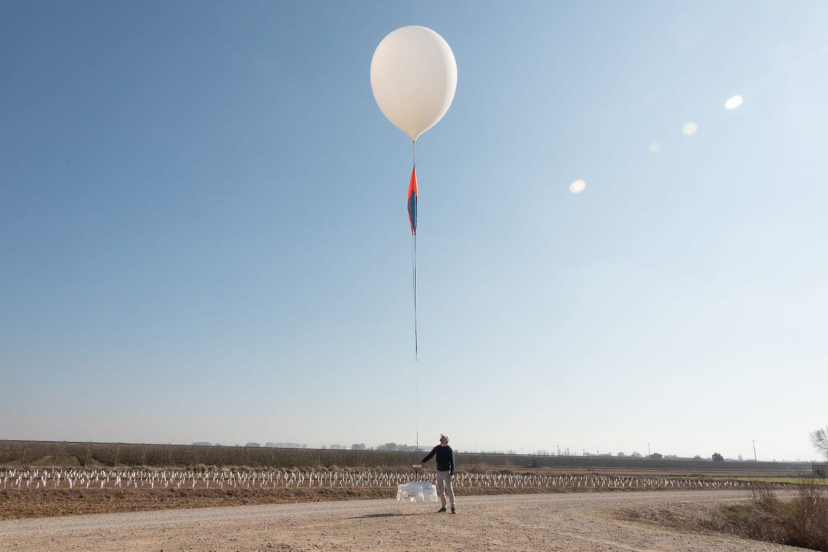
So, how does it all work? High-altitude balloons make the mission at NSL possible. They carry a small, autonomous robot called Swifty to capture the world around them at high resolution with zero carbon emissions. The balloons fly between 60,000 and 85,000 feet in the air, allowing Swifty to capture photos that cover up to almost 1,000 square kilometers.
A significant difference between NSL's unique space balloons and a typical satellite is that weather conditions don't inhibit NSL's balloons, as the balloons can enter the stratosphere immediately after inclement weather. By comparison, satellites cannot assume another position until they complete a full orbit. So, if cloudy weather hinders a satellite from capturing images, part of the orbit becomes a waste of time and money.
Popular now
NSL's Swifty can capture changes in the environment daily, such as progress on a construction project or property damage from a natural disaster.
Well, what about airplane imagery? Compared to Swifty, airplanes are too slow, too expensive, and don't pay enough attention to rural areas. On the other hand, Swifty can be thrust into the sky above commercial airspace immediately after severe weather and can easily hover over rural America.
SEE: Artemis launch plan: Here are NASA's next steps
Lastly, Swifty can capture images at a scale equivalent to all five boroughs in New York City combined compared to drone imagery. Swifty can also fly unmanned, without human navigation, unlike drones. Drones must adhere to federal aviation regulations and can only fly for short periods, unlike Swifty.
Since Swifty operates at a lower cost with increased efficiency and zero carbon emissions, NSL and other companies using the same technology have a leg up on traditional satellite imagery. It might be a matter of time before the sky is filled with autonomous robots sitting atop a balloon.